Home / map / index.html

Map of All Countries

Political World map

A to H

Arctic Ocean
Antarctic Region Outline
Argentina
Armenia
Aruba
Ashmore
Cartier Islands
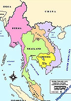
South East Asia Map
Asia Outline Map
Australia
Australia Oceania Map
Australian States Outline map
Location Australia Capital
Austria
Azerbaijan
Bahamas
Bahrain
Baker Island
Baltic Countries

Bangladesh
Barbados
Belarus
Belgium
Belize
Benin
Bermuda
Bhutan
Bolivia
Bosnia-and-Herzegovina
Botswana

Bouvet Island
Brazil
British Indian Ocean Territory
British Virgin Islands

Brunei
Bulgaria
Burkina Faso
Burma
Burundi
China
Canada
Camaroon
Cambodia
Chad
Chile
Congo
Costa Rica

Cuba
Cyprus
Denmark
Dominica

E to I

Ecuador
Egypt
El Salvador
Equatorial Guinea
Eritrea

Estonia
Ethiopia
Europa Island
Falkland Islands
Faroe Islands
Fiji
Finland
France

Gabon
Gambia
Gaza Strip

Georgia
Germany
Ghana
Gibraltar
Glorioso Islands
Greece
Greenland
Grenada
Guadeloupe

Guam
Guatemala
Guernsey
Guinea
Haiti
Guinea-Bissau
Guyana
Heard Island McDonald
Holy See (Vatican City)

Honduras
Hong Kong
Howland Island
Hungary
Iceland
India
Indian Ocean
Indonesia

Iran
Iraq
Ireland
Northern Ireland map

Israel
Italy

J to M

Jamaica
Jan Mayen
Outline Map Japan
Japan
Jarvis Island
Jersey
Johnston Atoll
Jordan
Juan de Nova
Islands
Kazakhstan
Kenya
Kingman Reef
Kiribati
Korea
Korea, South
Kuwait
Kyrgyzstan
Laos
Latvia
Lebanon
Lesotho
Liberia
Libya
Liechtenstein
Lithuania
Middle East
Moldova
Monaco
Mongolia
Montserrat
Morocco
Mozambique

Luxembourg
Macau
Macedonia
Madagascar
Malawi
Malaysia
Maldives
Mali
Malta
Man, Isle of
Marshall Islands
Martinique
Mauritania
Mauritius
Mayotte

Mexico
Outline Map Mexico
Micronesia, Federated States of
Midway Islands

N to S

Namibia
Nauru
Navassa Island
Nepal

Netherlands
Netherland, luxembourg, Belgium
Netherlands Antilles
New Caledonia
New Zealand
Nicaragua
Niger
Nigeria
Niue
Norfolk Island
Northern Mariana slands
Norway
Pacific Ocean

Pakistan
Panama
Palau
Palmyra Atoll
Papua New Guinea
Paracel Islands
Paraguay
Peru

Philippines
Pitcairn Islands
Poland
Outline Map poland
Portugal
Puerto Rico
Qatar
Reunion
Romania
Russia
Rwanda
Saint Helena
Saint Kitts and Nevis

Saint Lucia
Saint Pierre and

Saint Vincent and the Grenadines
Samoa
San Marino
Sao Tome and Principe
Saudi Arabia

Scotland
Senegal
Serbia and Montenegro
Seychelles
Sierra Leone
Singapore
Slovakia
Slovenia
Solomon Islands
Somalia

S to Z

South Africa
South Georgia
South Sandwich Islands
Spain
Spratly Islands
Sri Lanka

Sudan
Suriname
Svalbard
Swaziland
Sweden
Switzerland
Syria Taiwan Zimbabwe
Tajikistan
Tanzania
Thailand
Togo
Tokelau
Tonga
Trinidad and Tobago
Tromelin Island
Tunisia

Turkey
Turkmenistan
Turks and Caicos Islands
Tuvalu
Uganda
Ukraine
United Arab Emirates
United Kingdom
Outline Map UK
States Map UK
England
- USA
- Latin America
- Central America
- North America
South America South America Outline Map
Uruguay
Uzbekistan

Vanuatu
Venezuela
Vietnam
Virgin Islands
Wake Island
Wallis and Futuna
West Bank
Western Sahara
West Indies
Yemen
Yugoslavia
Zaire
Republic of the Congo
Zambia
Zimbabwe

Map of Asia

Map of Asia
World's largest and most populace continent know as Asia,It is covered earlier in the eastern andnorthern hemispheres around29.8% of its land area. with approx 4 billion people which cover 60% of the world's population. The Western part of Asia was occupied by Europe and earlier known as Eurasia. The Asia have very different due to wide variety of people and their traditions, places and its history, culture and colours.

Australia
Map of Australia

Native people of Australia had arrived here from South East Asia, at least 51,000 years ago. One million people lived in Australia at the time of discovery by European. They lived in 300 tribes and spoke 250 languages. Each tribe had their own land, god, spiritual values and trade. The tribes were depends on agriculture and hunting for survival


Canada
Map of Canada

Canada is the second largest country in terms of area; Canada is not behind with the neighbor US, although equally prosperous economically and technologically and Sharing its land border with the US. The country is a multicultural society, parliamentary democracy and constitutional monarchy. The attractions of Canada are mind blowing the scenic beauty, the northernmost country, it includes cosmopolitan cities including Ottawa, Montreal, Toronto and Vancouver, snow capped peaks, long coastlines.

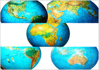
Globe Map Image

Worldmap image globe
World Map Image with their capital, neighbouring countries, it looks amazing and can be used for websites and other publications

Hand- logoMapsNWorld.com

Flags STD / ISD Pin Codes Currency Weather Current Time Sitemap